
Walking route: Roc de Tavaneuse from Prétairié

Hard
5h25min
4km
Round trip
+1020m
-1020m
Walking route: Roc de Tavaneuse from Prétairié image1Walking route: Roc de Tavaneuse from Prétairié image2Walking route: Roc de Tavaneuse from Prétairié image3Walking route: Roc de Tavaneuse from Prétairié image4
1 / 4

Description

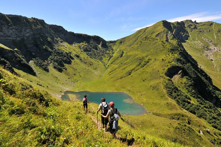
A sportive hike to reach the top of the Roc de Tavaneuse, this top offer you a magnificent view of the Mont Blanc. On the way down, you can enjoy the most beautiful lake of the Chablais: the lake of Tavaneuse!

The Roc de Tavaneuse, reserved for good walkers, is a beautiful summit to discover in the Vallée d'Abondance.

Starting from the Prétairié parking lot, you cross a forest.

THE PATH THROUGH THE SERRANANTS CHALETS HAS BEEN CLOSED SINCE SUMMER 2023 DUE TO A LANDSLIDE.
Variation: take the path that climbs steeply to the left before the Serranants chalets, or start from Lac des Plagnes (more gradual ascent, see itinerary).

Then follow the signs for the chalets de Tavaneuse to reach the lake.

The climb is fairly steep and there is little shade, so on hot days it's best to start out cool.

You'll reach the superb Tavaneuse mountain lake with its transparent turquoise waters.

The cliffs of the Petite Pointe du Piron and the Col de Tavaneuse overlook the lake. Follow the path to the Col de Tavaneuse (1997 m), then the ridge path to the summit of Roc de Tavaneuse.
A panoramic view of the Chablais mountains and the Mont Blanc massif awaits you.

The descent follows the same route to the lake, offering 3 possible alternatives to get back to the starting point.

Marking

Departmental markings called P.D.I.P.R. on beige metal panels with green lettering.

Map references

  • Map guide to 65 walks and hikes in the Evian region and Abondance valley
  • Map of walking routes in the Portes du Soleil area in France and Switzerland
  • IGN TOP 25 No. 3528 ET Morzine Chablais Massif Portes du Soleil

Amenities

Guided steps

THE PATH THROUGH THE CHALETS DES SERRANANTS HAS BEEN CLOSED SINCE SUMMER 2023 DUE TO A LANDSLIDE.
Alternative: take the path that climbs steeply to the left before the Serranants chalets, or start from Lac des Plagnes (more gradual ascent, see itinerary).

0/Departure : Prétairié.

1/ Take the path towards Les Serranants. On the path, fork left and climb the path through the alder forest. The path can be slippery.

2/ The narrow path climbs steeply towards the Tavaneuse stream. Once you reach a small promontory above the waterfall, the path climbs again, taking you to the Tavaneuse chalets.

3/ Continue beyond them to climb straight up into the combe to reach Lac de Tavaneuse.

4/ Turn right towards the Col de Tavaneuse.

5/ At the Col, take the path leading to the Roc de Tavaneuse.

6/ Take the same route down to Lac des Plagnes.

From Lac de Tavaneuse, there are three possible routes back to Prétairié:

  • via the ascent itinerary in 1h20, or more quickly in 1h by cutting through the alder forest;
  • via the Entre Deux Pertuis chalets in 2 hrs;
  • via Lac des Plagnes in 3h35.
Address
Parking de Prétairié, 74360, Abondance
Opening
From 01/06 to 15/10 daily. Check with tourist offices in advance to find out the current access conditions. Subject to favorable snow and weather conditions.

Was this content helpful to you?

Address
Parking de Prétairié, 74360, Abondance
Opening
From 01/06 to 15/10 daily. Check with tourist offices in advance to find out the current access conditions. Subject to favorable snow and weather conditions.