Walking route: Lake Tavaneuse from Prétairié and back

1 / 4
Hard
3h30min
5km
Round trip
+690m
-690m
Description
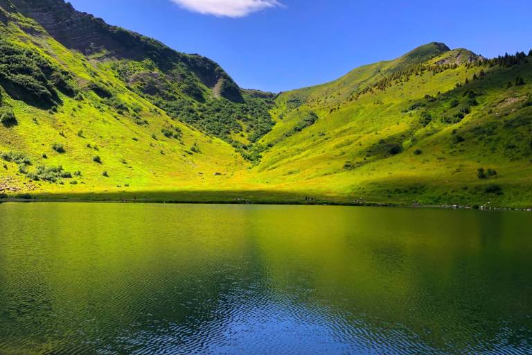
Discover one of the most beautiful gems of the Chablais region: Lake Tavaneuse, nestled at an altitude of 1,806 metres. This magnificent hike takes you to the heart of the Abondance mountain pastures, among flower-filled meadows, waterfalls and traditional chalets.
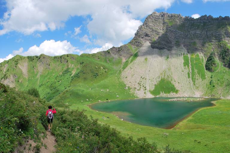
The hike starts from the Prétairié car park, where a pleasant trail gradually leads you to the Tavaneuse chalets. The path winds through forests and pastures, offering superb panoramic views of the surrounding mountains.
After a steep climb, you will finally reach Lake Tavaneuse, whose crystal-clear waters reflect the peaks of the Chablais. It is an ideal place for a well-deserved break: enjoy the peace and quiet, admire the colours of the lake and settle down for a picnic by the water's edge.
This round trip hike offers a good balance between effort and discovery, perfect for nature and mountain lovers.
Pricing
Free access.
Langues
Route GPX track
Parking de Prétairié, 74360, Abondance
From 01/06 to 15/10 daily.
Check with tourist offices in advance to find out the current access conditions.
Subject to favorable snow and weather conditions.