

Walking route: Arvouin Lake Loop
Hard
5h20min
10.5km
Loop
+930m
-930m


1 / 4
Description
A beautiful hike which starts from the centre of the village of La Chapelle d'Abondance and offers superb views of the Cornettes de Bise, the lake of Arvouin, the village and the valley of Abondance.
This hike starts in the centre of the typical Haut Savoyard village of La Chapelle d'Abondance. It is located within the natural site of the Cornettes de Bise, classified Natura 2000.
You will take the road and then follow a forest path in the direction of Chevenne.
You will then take a pastoral track and a path towards the Vernaz pass at the foot of the imposing Cornettes de Bise mountain. At the pass, a magnificent view awaits you on its southern face.
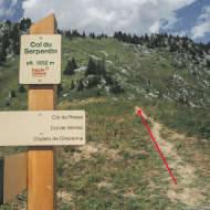
You will then reach the Col de Resse and then the Col du Serpentin and the Tête de l'Avalanche, the highest point of the route at 1854m. This viewpoint on the lake of Arvouin, the Dents du Midi and the valley of Abondance is worth the diversions.
It is also an area frequented by mouflons, marmots and grouse roosters.
After a short descent through the alpine chalets, you can enjoy a moment of relaxation at the edge of the Arvouin lake. You may meet Abondance cows or ibexes, which are very present on this site.
The return to the village of La Chapelle d'Abondance is via a fairly steep path through the Tête de la Maisonnette mountain pasture and a long descent through the forest.
Difficult sections
To cross a steep passage towards the Col de Resse, you will need to use a handrail (chain) for a short distance.
Marking
Departmental markings called P.D.I.P.R. on beige metal panel and green writing.
Map references
- Map guide to 65 walks and hikes in the Evian region and Abondance valley
- Map of walking routes in the Portes du Soleil area in France and Switzerland
- IGN TOP 25 No. 3528 ET Morzine Chablais Massif Portes du Soleil
Amenities


Guided steps
Sustainable Tourism
The wetland bordering the Lac d'Arvouin below the chalet is a sensitive and protected heritage area.
To avoid trampling and preserve this rich and fragile ecosystem (protected flora and breeding ground for aquatic fauna), please do not walk around Lac d'Arvouin and stay on the main track leading up to the chalet.
Our mountain lakes are fragile environments, and our actions have an impact on these ecosystems, so please don't swim in them (dogs included).
When you swim, you leave behind sunscreen, bacteria and organic particles that disturb the ecological balance.