Tour of Lac des Plagnes


1 / 7
Easy
45 minutes
1.8km
Loop
+47m
-47m
Description
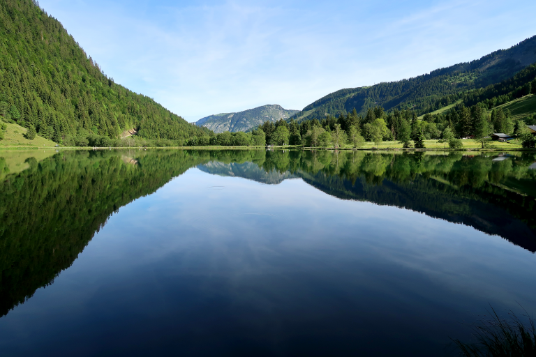
The Lac des Plagnes is the largest lake in the Abondance valley. Accessible by car, it is located 5 km from the centre of Abondance village. A short walk around the lake to refresh yourself in a mountainous setting.
The tour of Lac Plagnes is a pleasant little hike in summer. Picnic tables and benches allow you to enjoy this refreshing spot.
Lac des Plagnes is a Chablais Unesco Geopark site. From glaciers to bulging peat bogs, the trail around the lake takes you through landscapes that have evolved over the past 20,000 years.
In May and June, when the ice melts, the lake is at its highest, and the turquoise waters and snow-covered peaks make it a magnificent place to discover. At the end of the lake, you can take a variation via the Cubourré waterfall, where you'll discover some lovely cascades.
From the lake, you can see the sunny side of Mont de Grange, the highest point in the Abondance valley at 2,432 m.
This hike is accessible to all, as the tour of the lake is designed for the general public.
Pricing
Free access.
Route GPX track
Parking du lac des Plagnes, 74360, Abondance
From 01/05 to 01/11 daily.
Trail accessible with the arrival of good weather. In case of snowfall, avalanche passages. Access prohibited at the end of the lake in winter. Ask at the Tourist Office.