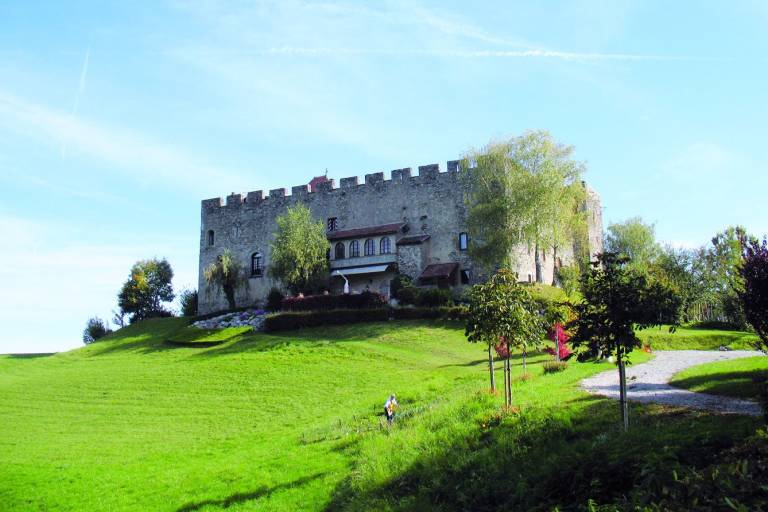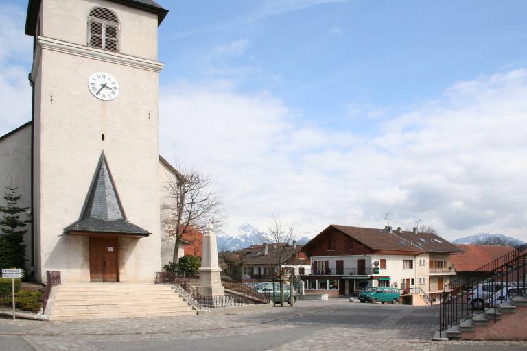
In addition to its beautiful views of Lake Geneva, the Valais Alps and the French Pre-Alps, the trail will take you through the village of Larringes, which has preserved all its authenticity and will immerse you in the history of Savoy (castle).
This easy hike starts in front of Mont Blanc. An orientation table is located a few metres from the start. The soul of Larringes is located on the village square with the church, the town hall and the basin of pure and fresh water which waters the herds evening and morning for 6 months.
The path then plunges you into the history of Savoie, at the foot of the castle from where you can dominate the plain, the mountains and the banks of the lake. The undergrowth of fayards leads to a health trail, which can be followed by a visit to a local producer (sausage and cheese).
Departmental signage known as P.D.I.P.R. on a beige metal sign with green lettering.
0/ Starting point: Larringes Cemetery parking lot.
1/ Take Route D32 toward “Vinzier.” At the roundabout, turn left onto “Chemin de Pugny.” At the castle, turn right onto “Chemin de Chery.” After a few meters, turn right. The small road becomes a path that winds through the meadows. You’ll come out onto a small road; follow it to the left.
2/ Follow signs for “Chez Crosson” and pass in front of a chapel, then turn right. Stay on the main path. At a fork near a hunting cabin, take the left path; at the next fork, turn right; at a third fork (fitness trail obstacle course), take the left path and follow the fitness trail route. Cross a meadow. Then turn right, back into the woods, toward “Saint-Paul-en-Chablais.”
3/ At the next intersection, leave the marked trail and continue straight ahead. Cross the D52 road diagonally to the right, toward the “Sentier du Maravant.” Take the trail that starts under the spruce trees. At a fork, two signs indicate, respectively, the direction you just came from and a right turn toward “La Pastourelle”; ignore these signs and take the left onto a barely marked trail. You’ll emerge onto a small road.
4/ Follow the road to the right and cross “Le Maravant” over a small bridge. Then, take the left-hand path and continue along a small road. Take the road to the left and enter “Cré Bouché.” Walk through the hamlet. When you reach the last houses, follow the yellow trail markers and turn right.
5/ At the next intersection, ignore the yellow markings, continue straight ahead, and you’ll come out onto the D352 road. Follow this road for about 250 m. Then, turn left onto a path between the meadows. Directly opposite the Oratoire du Perron, located to the left of a clearly visible power pole, go around the hill on the right as the path becomes less distinct (do not climb straight up the slope toward the oratory; respect the meadows). At the intersection near the power pole, turn left. Continue slightly uphill until you reach the oratory. Retrace your steps.
6/ Follow Route D352 to the right and turn left at “Bois du Ban” until you reach the intersection with the marked trail. Take the trail to the left. Stay on this main trail. At the intersection with a small road, take that road to the left. At the next intersection, take the small road to the right. Pass an oratory on the left and head downhill to enter “Larringes.” At the fork, turn right and cross a stream. Head back uphill and you’ll quickly reach the church.
To help protect agricultural practices, natural areas, and wildlife, please keep your dogs on a leash and pick up after them. Please keep and sort your trash, stay on the trails, and close any gates behind you.